


News

Weather
Posted: Jun 06, 2025 1:37 AMUpdated: Jun 06, 2025 6:45 AM
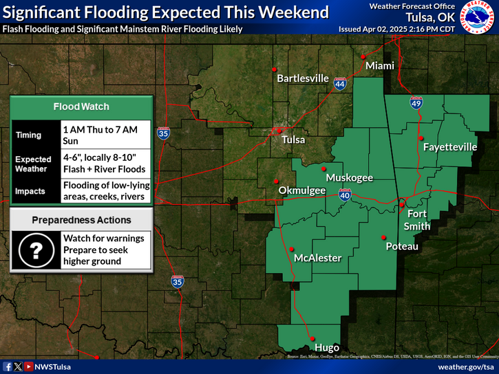
Flood Watch in Effect

More heavy rain is expected Friday night as the active weather pattern continues. These rains could lead to flash flooding and rises on mainstem rivers due to already saturated conditions. A Flood Watch is now in effect from tonight through Saturday morning. Additional heavy rain is expected over the weekend, increasing the potential for more flooding.
KOTV News on 6 Meteorlogist Alan Crone
While the region received significant rainfall this morning, the greater severe weather threat is expected to accompany another overnight thunderstorm complex forecast to develop well to the west and move eastward into early Saturday morning. Damaging winds up to 75 mph, large hail, and a limited tornado threat are possible with this system, along with continued heavy rainfall. Be sure to have at least three ways to receive weather warnings, including alerts designed to wake you.
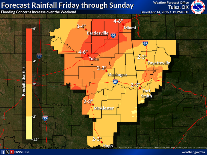
Strong to severe thunderstorms are expected to continue Saturday morning across parts of the area, with additional storms likely to develop into the afternoon and evening. Large hail and damaging winds will remain the primary threats, along with heavy rainfall.
Stay tuned to Bartlesville Radio — KWON AM 1400/FM 93.3 and 95.1, KRIG 104.9, KYFM 100.1, and KPGM AM 1500/FM 99.1.
« Back to News